Project Area
Most projects are about somewhere. Project area is where you say where: a suburb, a council area, a park, a road corridor, a site with a buffer around it, or several of these. Say it once and the rest of CE Canvas reads it — the project home, EVA’s advice, discovery, activity logistics, the Engagement Plan and any interactive map you build.
Open it from Project area in the project sidebar. It is optional, never blocks anything, and you can add it whenever it becomes useful.
If you skip this: “the community” means whoever turns up. Activities land where a venue was free rather than where the affected people live, EVA advises about a place it cannot see, and a stakeholder list from the last project stands in for the people who live with this decision. Saying where the project is takes a minute and makes every later step specific.
Project Area is a beta feature, enabled per organization. If you cannot see it, ask your CE Canvas contact.
Defining the area
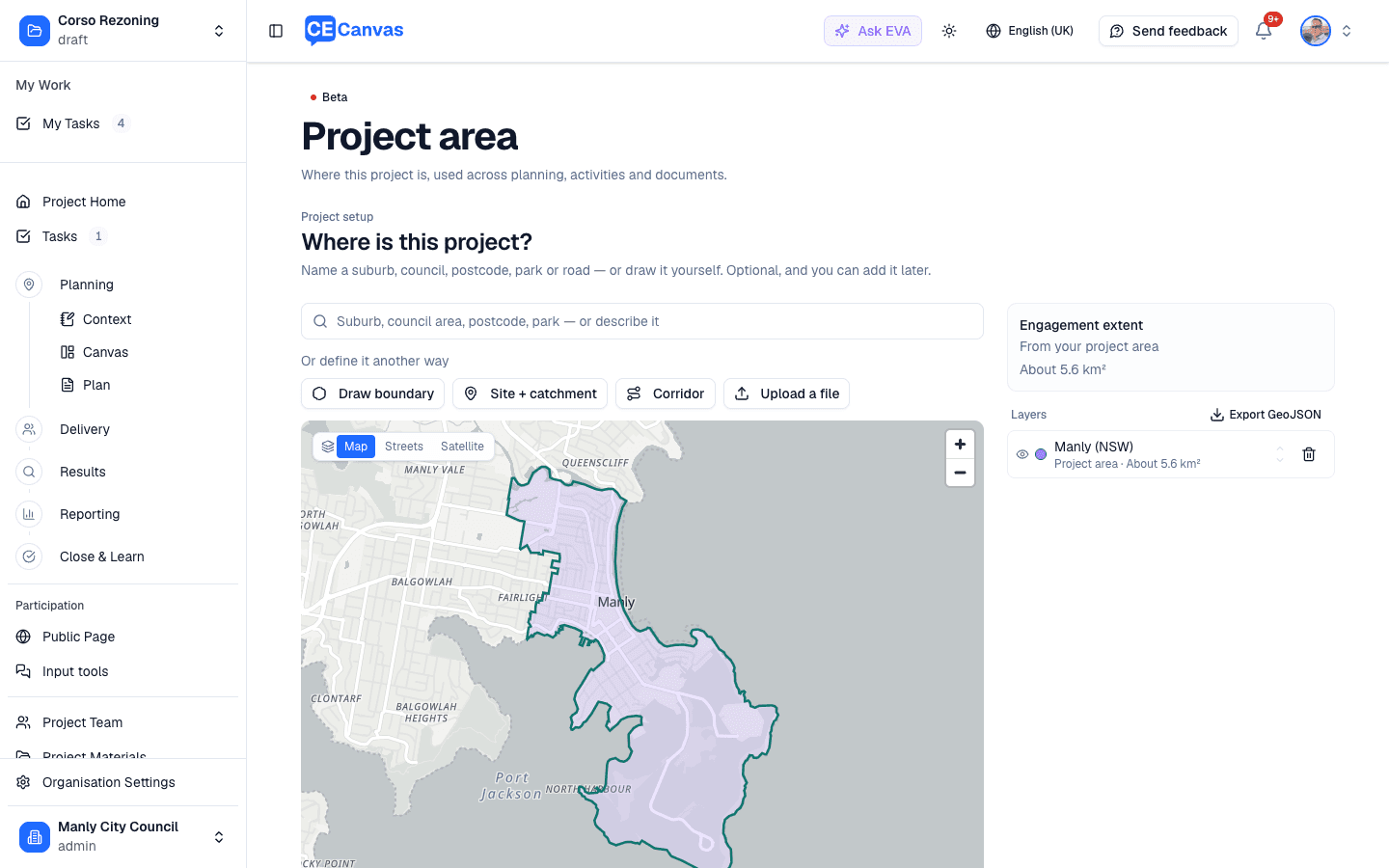
Naming a place is the usual path. Type a suburb, council, park, beach or road — or, for Australian organizations, a postcode — into Search for a place and pick from the candidates; the official boundary (or the park’s real outline, or the road’s centerline) is fetched only for the one you choose, and you see it on the map before it is saved. Or use the toolbar to draw a shape, drop a point and choose a distance around it, trace a corridor and choose a width either side, upload a GeoJSON or KML file, or describe the area in words and confirm what CE Canvas proposes.
Each layer has a role, which is what CE Canvas does with it:
| Role | What it means |
|---|---|
| Project area | Where the project or decision applies. Several combine into one extent. |
| Engagement area | The community the engagement intends to reach. At most one; when set, it is the extent everything else reads. |
| Another layer | An option, a route, a zone, a site — shown on the map, drives nothing. |
Give each layer a name and, where it helps, a short description in your own words. The description is what EVA and the Engagement Plan quote; the shape itself is for maps and checks.
The Engagement extent block shows the one shape the rest of the product uses and says where it came from: your engagement area, or your project areas combined.
Boundaries a connected partner sends arrive under Received boundaries. They are shown on the map but are not part of the project area until you Adopt one.
Where it shows up
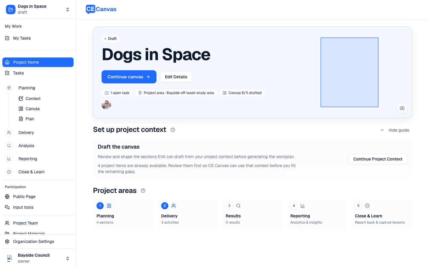
- Project Home shows the area’s outline as the hero picture when the project has no feature image, and a Project area chip that opens the area page.
- EVA reads the area — your names and descriptions, the size, and which layer is the extent — as canonical context in chat and when drafting canvas sections, so stakeholder proposals can say which place they are about. EVA never invents boundaries or distances; with no area it says nothing about one.
- Discovery carries the area’s place names into its searches, so you do not type a location anywhere else.
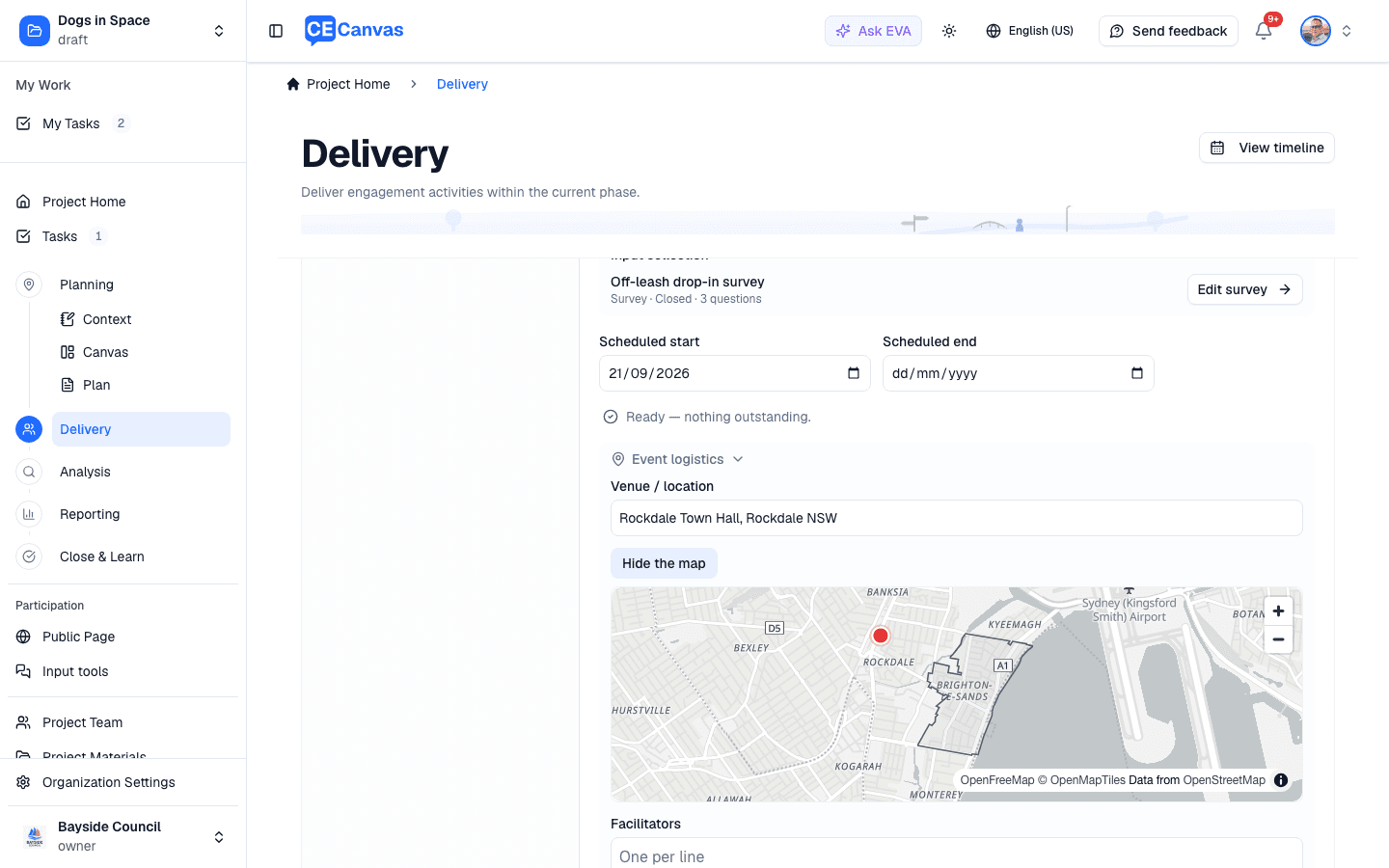
- Activities: on an activity’s Details tab, once a venue is typed, Show on the map places it against the project area.
- Engagement Plan: the Introduction section has a Project area field, prefilled from your descriptions, the areas by name and the size. Use Refresh from project on the section when the area changes.
- Input tools: an interactive map, or a survey with a map question, can bring the project’s areas and any received boundaries onto its own map. See Input tools.
The map an input tool builds on
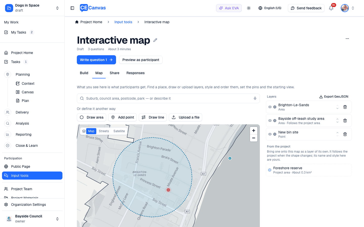
An input tool’s Map tab is the same editor as the Project area page, over the tool’s own layers. Under From the project it offers the project’s areas and any received boundaries. Add to map copies one onto the tool’s map as a layer of its own: you can rename it, restyle it, hide it or remove it without touching the project area. The copy follows the project — when the area’s shape changes, the layer changes with it, on a draft and on a live map alike. Its name and style here stay yours. If the project area is deleted, the layer stays as an ordinary layer.
Community context
With the area set, the Community context panel beneath the map shows census figures for the people who live there — see Beta features for availability. The area is also what the Partner API attaches partner-sent boundaries and measures to; see Partner API.